🌧️ Rain totals of 2–4 inches are expected through Friday, with the heaviest periods Thursday night into Friday.
⚠️ Flash flooding and isolated severe weather are possible but not expected to be widespread.
🌊 Dangerous surf and rip current risks will rise as the system moves west through the Gulf.
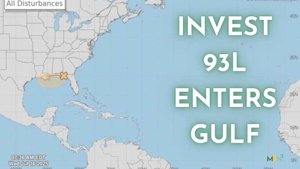
NICEVILLE — Okaloosa County Public Safety Director Patrick Maddox says his office continues to monitor Invest 93L, a tropical disturbance moving westward across the Gulf of Mexico, with the latest projections suggesting limited strengthening and moderate local impacts.
In a Wednesday update, Maddox noted that while the system still carries the potential to organize into a named storm — possibly Tropical Storm Dexter — most forecast models indicate that the system will remain close enough to land to limit its development.
Regardless of whether it earns a name, the expected impacts to Okaloosa County will be similar: increased rain chances through Friday, a risk of flash flooding in isolated areas, and dangerous surf conditions.
Storms are expected to move from the northeast to the southwest, with the heaviest rain likely late Thursday into Friday. Forecast models indicate that 2–4 inches of rain may fall across the area by the end of the week. Short periods of heavy rainfall could lead to localized flash flooding, especially in low-lying areas, though a significant, widespread flood or wind event appears unlikely.
While conditions aren’t expected to lead to a long-duration washout, residents should anticipate intermittent storms and rain bands over the next three days.
Maddox’s update also flagged rip current risks and hazardous surf as concerns, advising residents and visitors to exercise caution at area beaches as the system approaches our area.
As with any tropical system, brief tornadoes remain a possibility as the disturbance nears the coast, though current confidence in any such development remains low.