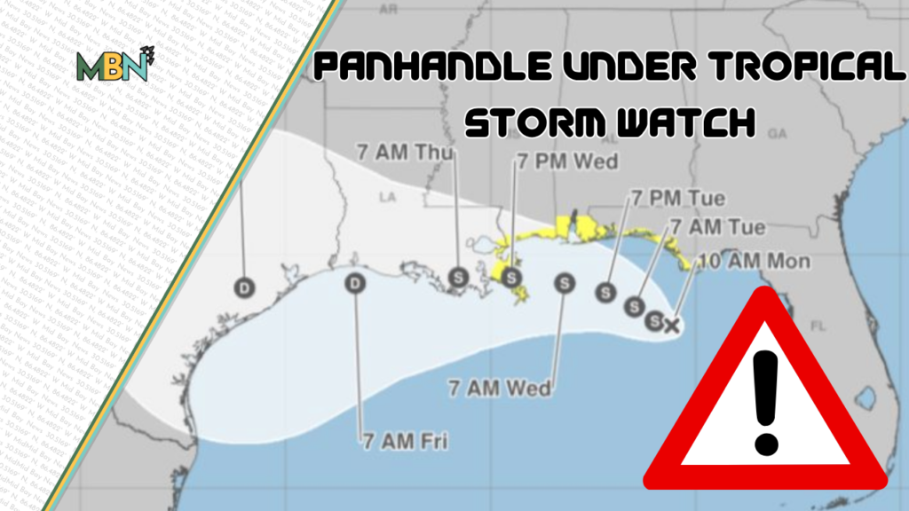

The National Weather Service forecasts a tropical depression about 120 miles south of the Florida Panhandle will develop into Tropical Storm Bertha today. Okaloosa County is under a Tropical Storm Watch through Tuesday evening.
According to Tallahassee’s NWS Forecast Office, the storm is not expected to make landfall in Florida as of Monday morning.
“Tropical Depression Two has only strengthened minimally over the last 24 hours as it has drifted northwest across the Gulf,” the Forecast Office said on its website. “Persistent northerly wind shear and dry air intrusion has limited the ability of the storm to intensify much more than what we’ve seen. It remains fairly disorganized this morning per latest satellite and radar imagery.”
Tropical Depression 2 is reportedly moving slowly across the Gulf, around 3 miles-per-hour, with maximum sustained wind speeds around 35 mph.
“We don’t like slow and we don’t like meandering because it gives these things time to think, and that’s never a good thing,” Okaloosa County Public Safety Director Patrick Maddox said. “But in this particular case, the conditions just aren’t there for rapid intensification, so we’re thankful for that.”
The 11 a.m. update from the Tallahassee Forecast Office said the depression has gotten “better organized” today but still predicts “the main concerns will be heavy rains, gusty showers, and rip-currents/heavy surf.”
“This is something to be aware of, but it’s absolutely nothing to freak out about,” Maddox said. “… And the folks that live here; They understand what this level of impact is. It’s very, very minimal. You’re going to have high surf conditions. You’re going to have perhaps some nuisance inundation, maybe one to three feet of tidal rise, which doesn’t affect any structures or homes here in Okaloosa County.”
Though the Okaloosa County Emergency Operations Center has not been activated, Maddox said the county is staying prepared.
“Command staff is monitoring every update,” he said. “We engage in calls and briefings with the National Weather Service. We engage in calls and briefings with the Florida Division of Emergency Management and our regional liaisons to that agency. We make sure that we have no unmet needs. We make sure that we don’t forecast anything that we can’t prepare for.”
Maddox urged residents and visitors to stay inside while the tropical storm watch is in effect.
“If you can hear the roar of the thunder, it’s time to go indoors,” he said. “Don’t play in a tropical system. It’s nothing to fool with. Even a low-level impact like this, heavy winds and strong winds can blow objects around.”
Maddox said beach patrol will enforce water closures if county beaches raise the double red flag.
Mid Bay News will continue to monitor developments. For the most current updates regarding Tropical Depression 2, visit the NWS website.